
New Findings on Rasuwa Flood
Sabika Shrestha
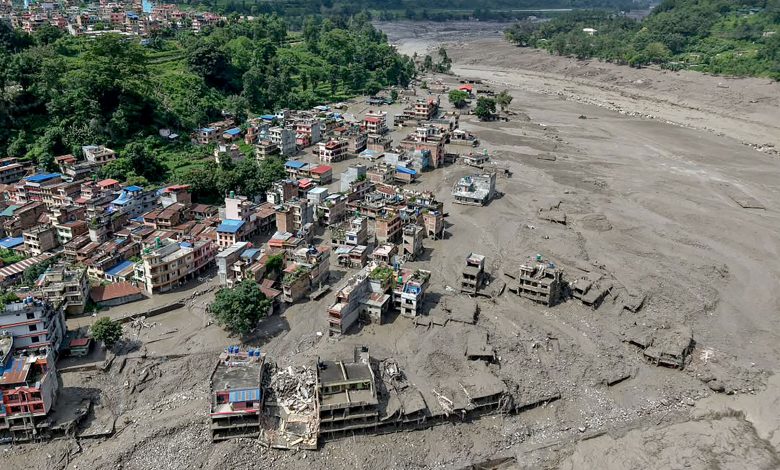
Nepal’s second technical assessment of the August 26 Rasuwa disaster has substantially narrowed the explanation for the catastrophic Bhote Koshi flood, ruling out extreme rainfall as its primary trigger and reconstructing a cascading high-altitude failure involving glacier ice, rock, river blockage and sudden flood release.
But the assessment leaves one crucial question unresolved: what caused the mountain mass itself to collapse?
Satellite analysis shows that approximately 2 sq. km of glacier and associated rock mass detached from the northern side of Langtang Lirung at around 5,200 metres. The mass plunged nearly 1,200 to 2,000 metres, generating a massive surge of ice, rock, debris and water that entered the Bhote Koshi river system.
The collapse also blocked the river, creating temporary impoundments that stored large volumes of water and debris. When these barriers failed or were overtopped, the stored material was released suddenly, intensifying the flood and carrying destructive debris downstream.
The assessment found only minimal rainfall before the event, ruling out extreme precipitation as the primary trigger. It also reconstructed the extraordinary speed of the flood, with the surge travelling around 22 kilometres to Rasuwagadhi in roughly seven minutes.
The flood then swept downstream through the Trishuli and Narayani River systems, while two temporary natural lakes formed by the collapse created additional risks of secondary outburst floods. These lakes could pose continuing danger if their natural barriers weaken or fail during future rainfall, melting or further slope movement.
The report says the event exposes major limitations in Nepal’s conventional rainfall-based flood forecasting system, as such high-altitude failures can occur with little warning. A warning system focused mainly on rainfall and river levels may not detect the initial collapse quickly enough to protect downstream settlements and infrastructure.
It recommends stronger real-time monitoring through CCTV, hydrological stations, satellite observation and improved early-warning systems. The assessment also highlights the need for closer monitoring of unstable glaciers, steep mountain slopes and newly formed natural lakes in high-risk areas.
However, the assessment stops short of establishing why the glacier-rock mass failed in the first place, calling for further geological, glaciological and climate-related investigation. Determining whether the collapse was linked to structural weakness, long-term glacier change, permafrost degradation or another geological process will be essential for assessing the risk of similar disasters in the future.



Comments